Posts

Bild
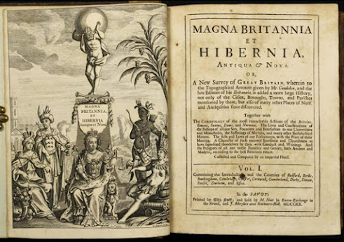
    Magna Britannia   - Robert Morden´s smaller series of maps 1701 - Introduction This blog deals mainly with the repeated issue of Robert Morden´s smaller maps , first published 1701 but still on sale in the early 1800s. These maps first appeared in an atlas style work in 1701 which was reissued a number of times in 1704 and 1708. In 1715 a serial atlas publication began which would spread over 92 issues and 17 years. Many collectors have this version of the map with accompanying text pages and are not sure of the source / publication details. I have tried to compile a list of all the various issues, with and without title pages, and illustrated all the title pages found so far. Part 1. History: deals with the background to what became known as Thomas Cox´s Magna Britannia and the publication details up to 1731. Part 2. Publication History of the 92 Parts by county and issue. Part 3. Individual Counties before 1745 detailing variations in county volumes up to the sale of all stoc
Bild
1. History   Photo Courtesy of Philip Burden. Robert Morden ( fl . 1668-1703) is known as a globe-maker operating at least as early as 1668 and he was advertising his own printed works by 1671. [i] He occupied premises in New Cheapside and Cornhill where he carried on business under the sign of The Atlas as a map and book seller as well as maker of instruments and globes. He published the first recognisable county map playing card set with William Berry and others ( B&B 15 ) in 1676. Morden is thought to have engraved a series of maps shortly before 1693, for inclusion in Dr. Edmund Gibson´s new edition of  Camden´s Britannia  (which appeared in 1695) and may have rejected them as too small or there was some form of misunderstanding. [ii] Morden then produced a second, larger set of maps ( B&B 20 ). Dr. Edmund Gibson´s proposals of 1692 conceived the counties appearing in order from west to east and south to north. There was some delay and the final map plates were not re